

.jpg")
Flood Defences
Have you ever noticed that, during periods of heavy rainfall, we have less residential flooding in Milton Keynes compared to other areas of the UK? This is because Milton Keynes has a network of balancing lakes, floodplains and SUDS which store excess water. Find out more about the flooding defences in our parks below.
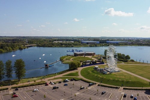
Balancing Lakes
All of the lakes in Milton Keynes are manmade and most were designed as balancing lakes. This means that the water levels in them can be raised to store water and reduce peaks of river flow, which reduces flood risk in downstream areas. The lakes are fed and controlled by a complex system of sluice gates and weirs.
When there is heavy rainfall, water from the River Ouzel is diverted into Willen Lake and Caldecotte Lakes to reduce the amount of water flowing through the river and lessen the risk of flooding. These are examples of ‘off-line’ balancing lakes, where weirs can be raised within the river channel to divert water into the lakes that lie beside the river. These weirs are controlled jointly by Anglian Water and the Environment Agency.
Furzton Lake, Lodge Lake and the Teardrop Lakes are balancing lakes within the Loughton Brook. These are examples of ‘on-line’ lakes because they are built within the watercourse, with fixed-level weirs and dam embankments that hold back water when flow rates increase.
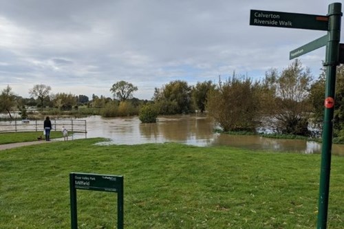
Floodplains
Many areas of our parks fall within and have helped to preserve the natural floodplains of our river valleys. We expect to see these park areas in flood during the winter months and the planting and habitat management that we do around these areas take account for this.
The Floodplain Forest Nature Reserve, Stony Stratford Nature Reserve and the Mill Fields at Stony Stratford flood with water from the River Great Ouse and much of our parkland in Simpson, Woughton and Woolstone floods from the River Ouzel. This means that part of the parks and paths are inaccessible at times during the year. This is normal and it means that the floodplains are doing their job. We wouldn’t have such large beautiful parks in MK if it weren’t for their purpose of accommodating floodwater.
Sustainable Drainage Systems
Many of the newer developments have local SUDS (Sustainable Drainage Systems) designed into their plans. These often form the heart of the park and the housing development is built around them, examples are Brooklands Meadows and Oxley Park. For parts of the year, these areas may look like dry ditches but when heavy rainfall comes, these ditches store the water that runs off from roads, paths, car parks and roofs creating a series of brooks and ponds. This means that the excess water runs away from the houses and so it prevents residential flooding.

Staying Safe in the Parks
Keep an eye on local weather forecasts so that you know when heavy rainfall is likely. You may have to change your route if part of the park that you usually visit is in flood. Do not enter the water under any circumstances and ensure dogs are kept on a lead away from the water’s edge as there may be hidden dangers underneath the water. If you see someone in trouble in the water, please call 999.
The video below from the weir at Willen Lake shows why it is so important to stay away from rivers and weirs. You can see the plank of wood being recirculated. There is no undertow to drag you out, but it will drag you back in. The Sluice Gates can be raised and lowered by Anglian Water without any warning; there are no flashing lights or sirens like you would get at a level crossing, that is why you should never enter the water, even in the summer when it looks calm!
Find out more about water safety in Milton Keynes here.

Who manages Milton Keynes' flooding defences?
The Environment Agency and Anglian Water are responsible for maintaining the flood defences in Milton Keynes. In the case of an emergency, you can contact the Environment Agency via their 24-hour Floodline on 0845 988 1188.


")


